Back to results 5,879 sqm Sloping Farmland for Sale in Kinokawa, Wakayama

Needs Verification

This listing hasn't been verified recently. Tap to request a priority check!

Know someone who would love this? Gift them a subscription

¥400,000

Yokotani, Kinokawa City, Wakayama Prefecture

和歌山県紀の川市横谷

Sign in to save properties

Buy Farmhouse Mountain Property Land Rural

Unlock the full description with a free trial

Includes AI translation, hazard data, cost estimates & nearby amenities

3 days free · cancel anytime

Start Free Trial

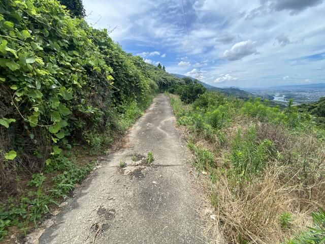
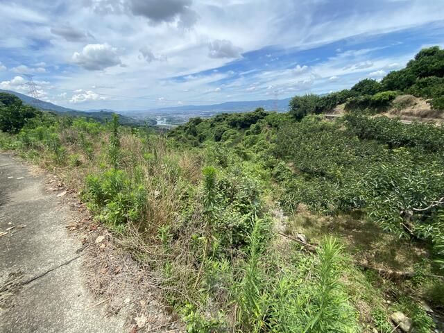
Expansive Sloping Farmland in Kinokawa, Wakayama

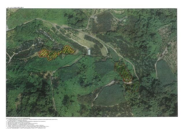
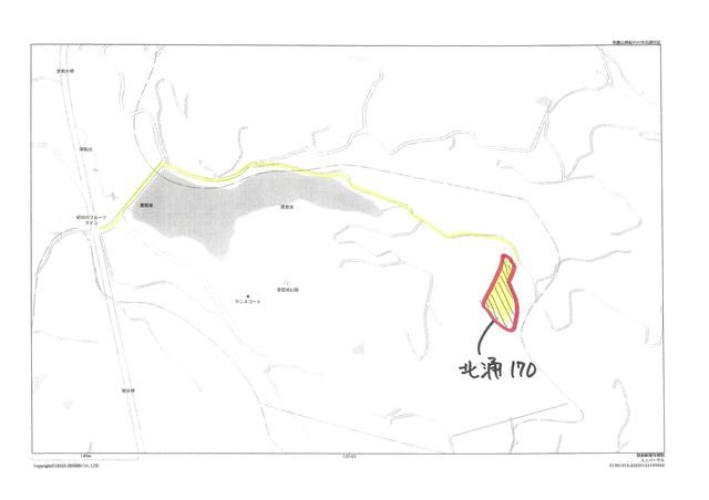
This listing presents a substantial plot of sloping farmland totaling 5,879 square meters (approximately 1,778.4 tsubo) in the Yokotani area of Kinokawa City, Wakayama Prefecture. The land is currently fallow, meaning it is not under active cultivation, and requires maintenance such as grass cutting. The property is comprised of multiple lots: three plots in Yokotani totaling 3,230 square meters, one in Asozu-naka of 405 square meters, and another in Kita-waku of 2,244 square meters.

The land is officially classified as farmland (畑) and is situated in a non-city planning area (非線引区域) with no designated use district. The building coverage ratio is 70% and the floor area ratio is 200%. The terrain is sloped (傾斜地), and road frontage is to the north with a width of 2.5 meters. The sale price is set at 400,000 JPY, with a negotiable handover date (引渡可能時期相談).

The surrounding area of Kinokawa offers a blend of rural tranquility and accessibility. An interesting local fact is that Kinokawa City is part of the wider Kishi region, historically known for its high-quality fruit production, particularly persimmons and peaches. The closest major landmark is the iconic Mount Koya (Koyasan), a sacred Buddhist site and UNESCO World Heritage location approximately an hour's drive away, renowned for its ancient temple complex and serene Okunoin cemetery.

This description was AI-generated from the original Japanese listing and may contain inaccuracies. Please verify details with the source listing.

Summary

Land size: 5,879 / 63,282sqft

Short-Term Rental (Minpaku)

Transport

KIX

Kansai International Airport — 26 km away

Nearest Konbini

circle_k Circle K — 11 min walk

Internet Connectivity

Natural Hazard Assessment

Flood Risk Low Risk
Landslide Risk Moderate
Tsunami Risk Low Risk
Earthquake Hazard Moderate

Unlock hazard data with a free trial

Flood, landslide, tsunami & earthquake risk for this property

3 days free · cancel anytime

Start Free Trial

Purchase Cost & Tax Estimates

Agent fees, acquisition tax, registration costs & annual property tax

Airbnb Revenue Estimate

Projected nightly rate, occupancy & net income for this property

Investment ROI

Annual yield, break-even timeline & 10-year return projection

Map & Street View

Map loading...

Location Accuracy Notice: Although we try to make the map accurate with coordinates or address details provided, the location data is provided by the agent. This map data should be used as reference for the surrounding area foremost.

Location Type Beds Price Land House View

* Sold properties shown for price comparison only. Prices reflect historical sale data.

Location Type Beds Rent/Month Land House View

* Rental prices shown are monthly rates. Contact property owner for current availability.

Dev Bot
Task #
Draw to highlight areas, then tap Done to attach