Back to results 871 sqm Land for Sale in Niseko's Middle Village Hirafu

Needs Verification

This listing hasn't been verified recently. Tap to request a priority check!

Know someone who would love this? Gift them a subscription

Price on Request

Yamada, Kutchan-cho, Abuta District, Hokkaido

北海道虻田郡倶知安町字山田165番

Sign in to save properties

Buy Business Land Ski Resort Area Rural

Unlock the full description with a free trial

Includes AI translation, hazard data, cost estimates & nearby amenities

3 days free · cancel anytime

Start Free Trial

Prime Development Land in the Heart of Niseko's Middle Village Hirafu

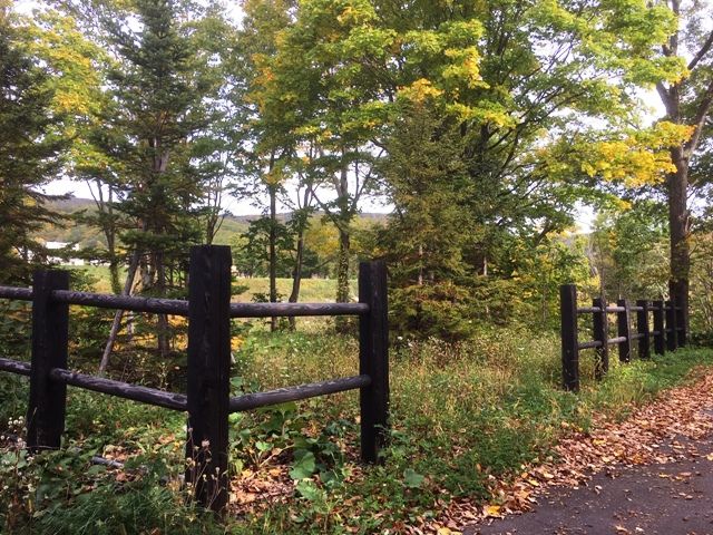
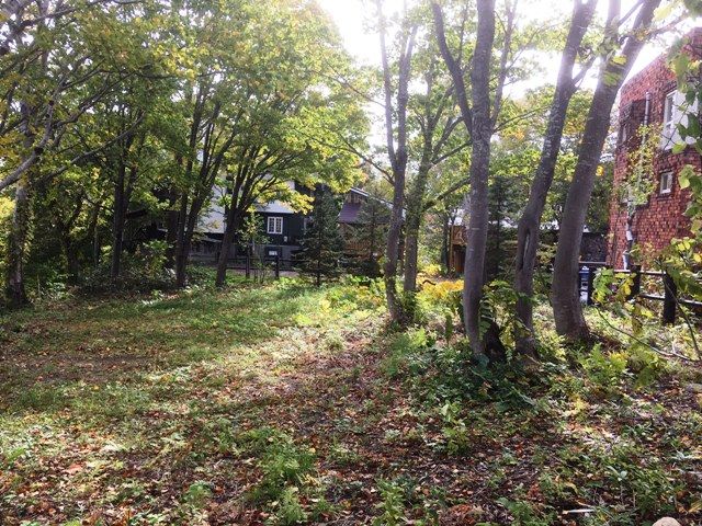
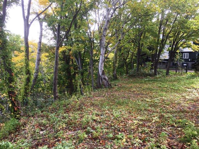
Presenting a highly sought-after development plot in the prestigious Middle Village Hirafu area of Niseko. This land parcel, identified as No. 90915, offers a substantial area of 871 square meters (approximately 263.48 tsubo), providing ample space for a custom-built home or investment property. The site benefits from frontage on two existing roads with widths of 5.3 meters and 5.8 meters, ensuring excellent access.

Critical infrastructure details from the agent notes confirm that connection to the town's public water supply is possible, and a sewer pipe is available along the municipal road, significantly simplifying development plans. The land is zoned within the Quasi-City Planning Area (Pension Village District) and falls under a Specific Use Restriction District (Tourism II Zone), with a building coverage ratio of 50% and a floor area ratio of 200%.

The property is situated in Yamada, Kutchan-cho, Abuta District, Hokkaido, a region world-renowned for its exceptional powder snow and vibrant international atmosphere. The location offers convenient access, being approximately a 13-minute drive (about 4.70 km) from JR Hirafu Station on the Hakodate Main Line.

The Niseko area is not just a winter paradise; it's a year-round destination with stunning natural beauty. A fascinating fact about the region is that the consistent, high-quality powder snow is a result of cold Siberian winds picking up moisture over the Sea of Japan before depositing it on the slopes of Mount Yotei and the surrounding ranges. The closest major landmark is the majestic, perfectly symmetrical volcanic cone of Mount Yotei, often referred to as "Ezo Fuji" for its resemblance to Mount Fuji.

This description was AI-generated from the original Japanese listing and may contain inaccuracies. Please verify details with the source listing.

Summary

Land size: 871 / 9,375sqft

Short-Term Rental (Minpaku)

Transport

CTS

New Chitose Airport — 81 km away

Nearby Konbini

Lawson Lawson — 9 min walk

Internet Connectivity

Natural Hazard Assessment

Flood Risk Low Risk
Landslide Risk Moderate
Tsunami Risk Low Risk
Earthquake Hazard Moderate

Unlock hazard data with a free trial

Flood, landslide, tsunami & earthquake risk for this property

3 days free · cancel anytime

Start Free Trial

Purchase Cost & Tax Estimates

Agent fees, acquisition tax, registration costs & annual property tax

Map & Street View

Map loading...

Location Accuracy Notice: Although we try to make the map accurate with coordinates or address details provided, the location data is provided by the agent. This map data should be used as reference for the surrounding area foremost.

Location Type Beds Price Land House View

* Sold properties shown for price comparison only. Prices reflect historical sale data.

Location Type Beds Rent/Month Land House View

* Rental prices shown are monthly rates. Contact property owner for current availability.

Dev Bot
Task #
Draw to highlight areas, then tap Done to attach