Back to results Land for Sale in Rankoshi, Hokkaido - 4,807 sqm with Stream

Needs Verification

This listing hasn't been verified recently. Tap to request a priority check!

Know someone who would love this? Gift them a subscription

Price on Request

703 YoshiKuni, Rankoshi Town, Isoya District, Hokkaido

北海道磯谷郡蘭越町字吉国703番

Sign in to save properties

Buy Land Ski Resort Area Corner Lot River View Well Water Rural

Unlock the full description with a free trial

Includes AI translation, hazard data, cost estimates & nearby amenities

3 days free · cancel anytime

Start Free Trial

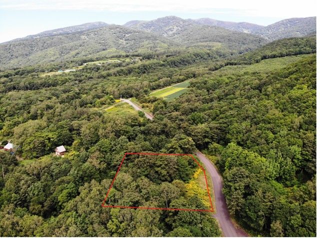
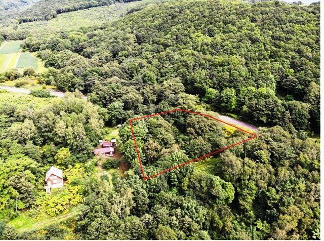
SilentLand YoshiKuni 1,454: A Sprawling Land Parcel with a Picturesque Stream in Niseko Region

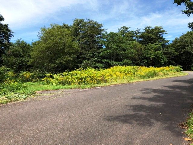
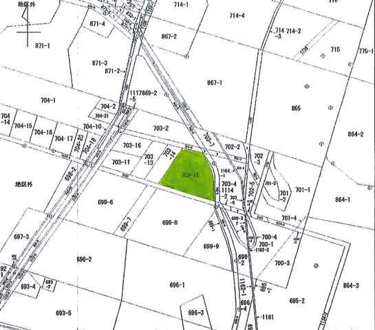
This expansive land parcel, designated as SilentLand YoshiKuni 1,454, presents a rare opportunity in the scenic Niseko area. Located in Rankoshi Town, Isoya District, Hokkaido, the property spans a substantial 4,807 square meters (approximately 1,454.12 tsubo). The land is classified as 'genya' (wilderness/field) and is situated on a corner plot bordered by an 8-meter wide paved public road to the east and a 7-meter wide unpaved public road to the south. A key feature noted in the agent's equipment list is that well drilling is required, indicating the need to establish a private water source.

The property falls outside of any urban planning area and has no designated land use zoning, offering significant flexibility for development. The legal building coverage ratio is 70% with a floor area ratio of 400%. A truly distinctive characteristic of this land is the presence of a beautiful, clear stream flowing through the property, adding immense natural charm and potential for landscape design. The transaction will be handled via agency, and the handover date is negotiable.

This description was AI-generated from the original Japanese listing and may contain inaccuracies. Please verify details with the source listing.

Summary

Land size: 4,807 / 51,743sqft

Short-Term Rental (Minpaku)

Transport

CTS

New Chitose Airport — 88 km away

Internet Connectivity

Natural Hazard Assessment

Flood Risk Low Risk
Landslide Risk Moderate
Tsunami Risk Low Risk
Earthquake Hazard Moderate

Unlock hazard data with a free trial

Flood, landslide, tsunami & earthquake risk for this property

3 days free · cancel anytime

Start Free Trial

Purchase Cost & Tax Estimates

Agent fees, acquisition tax, registration costs & annual property tax

Map & Street View

Map loading...

Location Accuracy Notice: Although we try to make the map accurate with coordinates or address details provided, the location data is provided by the agent. This map data should be used as reference for the surrounding area foremost.

Location Type Beds Price Land House View

* Sold properties shown for price comparison only. Prices reflect historical sale data.

Location Type Beds Rent/Month Land House View

* Rental prices shown are monthly rates. Contact property owner for current availability.

Dev Bot
Task #
Draw to highlight areas, then tap Done to attach