Back to results SILENTLAND Kondo SPECIAL 200 Land for Sale in Niseko, Hokkaido

Needs Verification

This listing hasn't been verified recently. Tap to request a priority check!

Know someone who would love this? Gift them a subscription

Price on Request

741 Kondo, Niseko Town, Abuta District, Hokkaido

北海道虻田郡ニセコ町字近藤741番

Sign in to save properties

Buy Land Ski Resort Area Rural Quiet Area Hiking Area

Unlock the full description with a free trial

Includes AI translation, hazard data, cost estimates & nearby amenities

3 days free · cancel anytime

Start Free Trial

SILENTLAND Kondo SPECIAL 200: A Spacious Land Parcel in Niseko's Tranquil Setting

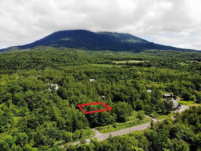
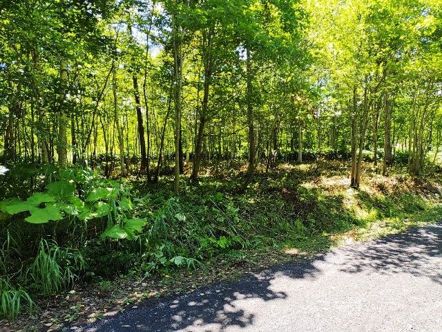
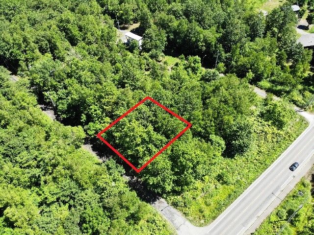
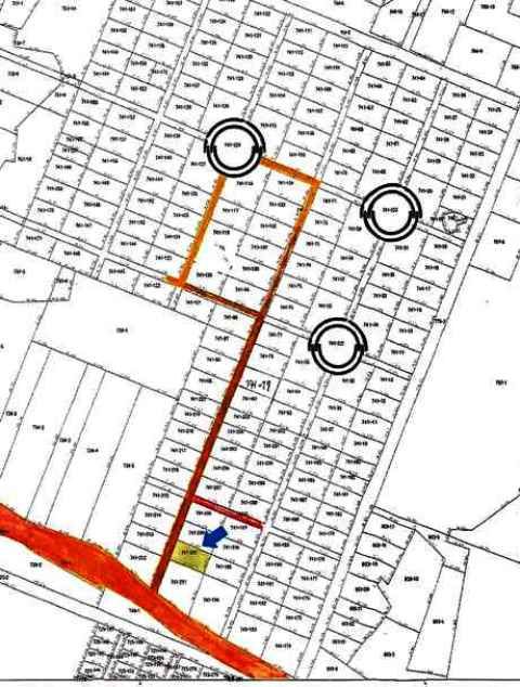
This land listing, SILENTLAND Kondo SPECIAL 200, offers a substantial 662 square meter (approximately 200.26 tsubo) plot located in a quiet subdivision at 741 Kondo, Niseko Town, Abuta District, Hokkaido. The property is designated as "wilderness" (原野) and falls outside of urban planning zones, providing flexibility for development within the parameters of Niseko Town's landscape ordinance, a 70% building coverage ratio, and a 400% floor area ratio.

A key facility for the plot is access to town water supply. The land is situated at the entrance of a peaceful residential development area. The transfer of the property is handled through an intermediary, with the specific timing open for discussion.

The location offers excellent accessibility, being approximately a 13-minute drive (about 7.24 km) from JR Hakodate Main Line's Niseko Station. The area is renowned for its world-class powder snow and outdoor activities, attracting international visitors year-round. A major landmark near Niseko is the iconic Mount Yotei, often called "Ezo Fuji" for its striking resemblance to Mount Fuji, which provides a breathtaking backdrop to the region.

This description was AI-generated from the original Japanese listing and may contain inaccuracies. Please verify details with the source listing.

Summary

Land size: 662 / 7,126sqft

Short-Term Rental (Minpaku)

Transport

CTS

New Chitose Airport — 77 km away

Internet Connectivity

Natural Hazard Assessment

Flood Risk Low Risk
Landslide Risk Moderate
Tsunami Risk Low Risk
Earthquake Hazard Moderate

Unlock hazard data with a free trial

Flood, landslide, tsunami & earthquake risk for this property

3 days free · cancel anytime

Start Free Trial

Purchase Cost & Tax Estimates

Agent fees, acquisition tax, registration costs & annual property tax

Map & Street View

Map loading...

Location Accuracy Notice: Although we try to make the map accurate with coordinates or address details provided, the location data is provided by the agent. This map data should be used as reference for the surrounding area foremost.

Location Type Beds Price Land House View

* Sold properties shown for price comparison only. Prices reflect historical sale data.

Location Type Beds Rent/Month Land House View

* Rental prices shown are monthly rates. Contact property owner for current availability.

Dev Bot
Task #
Draw to highlight areas, then tap Done to attach