Back to results 693.42 sqm Vacant Land for Rent in Okuma Town, Fukushima
Added 2 days ago

Know someone who would love this? Gift them a subscription

Price on Request

702-7, 710-1, 710-2 Shimotsunoue, Okuma Town, Futaba District, Fukushima Prefecture

福島県双葉郡大熊町大字下野上字大野702-7/710-1/710-2

Sign in to save properties

Rent Land Akiya Bank Corner Lot Rural

Unlock the full description with a free trial

Includes AI translation, hazard data, cost estimates & nearby amenities

3 days free · cancel anytime

Start Free Trial

Land for Rent in Okuma Town, Futaba District, Fukushima Prefecture

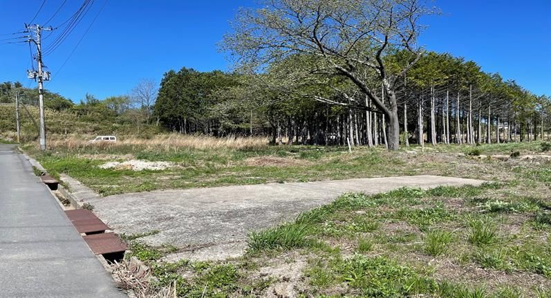
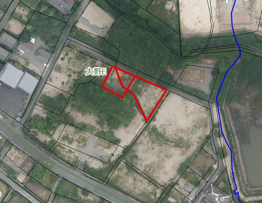
This is a vacant land plot available for rent, located in the Shimotsunoue area of Okuma Town, Futaba District, Fukushima Prefecture. The property is situated at addresses 702-7, 710-1, and 710-2, offering a total land area of 693.42 square meters (approximately 209.75 tsubo). The land is currently in a cleared state (更地).

The property is equipped with essential utility connections, including public water supply (公営水道), sewage system (下水道), and mains water (上水道). The site is located in a non-line-drawn urban planning area (非線引区域) with a designated Category 1 Medium-to-High-Rise Residential Zone (1種中高). The building coverage ratio is 60%, and the floor area ratio is 200%. The land classification is residential land (宅地).

Access to the property is via JR Joban Line, with Ono Station approximately a 16-minute walk away. The rental price is negotiable (相談), and management fees are unknown. Deposit and key money details are also not specified. The property is available for immediate handover (即引渡可). The contract period and renewal fees are to be discussed. This listing is part of the Okuma Town Akiya Bank program.

This description was AI-generated from the original Japanese listing and may contain inaccuracies. Please verify details with the source listing.

Summary

Land size: 693 / 7,464sqft

Short-Term Rental (Minpaku)

Transport

NRT

Narita International Airport — 190 km away

Nearby Konbini

Lawson Lawson — 21 min walk

Internet Connectivity

Natural Hazard Assessment

Flood Risk Low Risk
Landslide Risk Moderate
Tsunami Risk Low Risk
Earthquake Hazard Moderate

Unlock hazard data with a free trial

Flood, landslide, tsunami & earthquake risk for this property

3 days free · cancel anytime

Start Free Trial

Purchase Cost & Tax Estimates

Agent fees, acquisition tax, registration costs & annual property tax

Map & Street View

Map loading...

Location Accuracy Notice: Although we try to make the map accurate with coordinates or address details provided, the location data is provided by the agent. This map data should be used as reference for the surrounding area foremost.

Location Type Beds Price Land House View

* Sold properties shown for price comparison only. Prices reflect historical sale data.

Location Type Beds Rent/Month Land House View

* Rental prices shown are monthly rates. Contact property owner for current availability.

Dev Bot
Task #
Draw to highlight areas, then tap Done to attach