Back to results Foresthill Toyoka Land for Sale with Mount Yotei Views in Rusutsu

Needs Verification

This listing hasn't been verified recently. Tap to request a priority check!

Know someone who would love this? Gift them a subscription

Price on Request

395 Toyoka, Rusutsu Village, Abuta District, Hokkaido

北海道虻田郡留寿都村字豊岡395番

Sign in to save properties

Buy Mountain Property Land Ski Resort Area Panoramic View Forest Rural

Unlock the full description with a free trial

Includes AI translation, hazard data, cost estimates & nearby amenities

3 days free · cancel anytime

Start Free Trial

FORESTHILL Toyoka 1,557: A Spacious Land Parcel with Breathtaking Mount Yotei Views

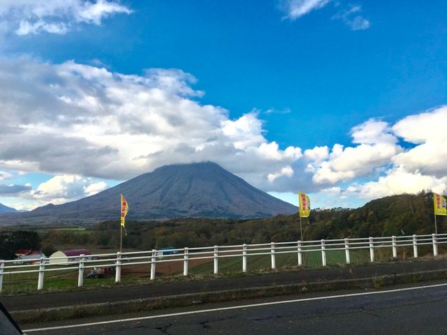
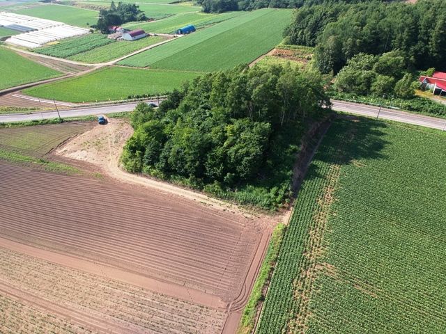
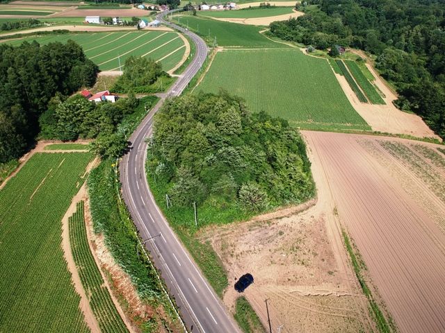
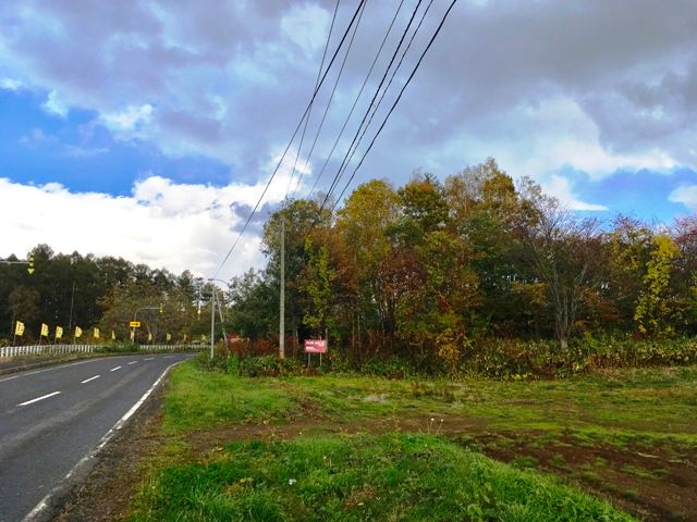
This expansive land offering, FORESTHILL Toyoka 1,557 (Yotei View), presents a rare opportunity to own a substantial 5,150 square meter (approximately 1,557.88 tsubo) plot in the serene setting of Rusutsu Village, Hokkaido. The property is designated as forest land and features a flat topography, making it an ideal canvas for development. A key piece of equipment information is that a 40mm village-managed water supply line is located across the prefectural road, approximately 50 meters from the property boundary.

The land boasts a highly favorable 70% building coverage ratio and a 400% floor area ratio, providing significant flexibility for construction. It is situated on a slight elevation surrounded by fields and trees, offering uninterrupted and spectacular panoramic views of Mount Yotei (Mt. Yotei), a defining landmark of the Niseko area. The property fronts the Prefectural Road No. 66 (Iwani-Toya Line) with 96 meters of road frontage, ensuring excellent access. The location is outside of city planning zones and is designated as an unspecified area under the Forest Law.

This description was AI-generated from the original Japanese listing and may contain inaccuracies. Please verify details with the source listing.

Summary

Land size: 5,150 / 55,435sqft

Short-Term Rental (Minpaku)

Transport

CTS

New Chitose Airport — 69 km away

Nearby Konbini

Lawson Lawson — 27 min walk

Internet Connectivity

Natural Hazard Assessment

Flood Risk Low Risk
Landslide Risk Moderate
Tsunami Risk Low Risk
Earthquake Hazard Moderate

Unlock hazard data with a free trial

Flood, landslide, tsunami & earthquake risk for this property

3 days free · cancel anytime

Start Free Trial

Purchase Cost & Tax Estimates

Agent fees, acquisition tax, registration costs & annual property tax

Map & Street View

Map loading...

Location Accuracy Notice: Although we try to make the map accurate with coordinates or address details provided, the location data is provided by the agent. This map data should be used as reference for the surrounding area foremost.

Location Type Beds Price Land House View

* Sold properties shown for price comparison only. Prices reflect historical sale data.

Location Type Beds Rent/Month Land House View

* Rental prices shown are monthly rates. Contact property owner for current availability.

Dev Bot
Task #
Draw to highlight areas, then tap Done to attach