Back to results 14,503 Tsubo Forest Land for Sale in Rankoshi, Niseko Area, Hokkaido

Needs Verification

This listing hasn't been verified recently. Tap to request a priority check!

Know someone who would love this? Gift them a subscription

Price on Request

237-1, 237-5 Tomioka, Rankoshi Town, Isoya District, Hokkaido

北海道磯谷郡蘭越町富岡237-1、237-5

Sign in to save properties

Buy Mountain Property Land Ski Resort Area Forest Rural

Unlock the full description with a free trial

Includes AI translation, hazard data, cost estimates & nearby amenities

3 days free · cancel anytime

Start Free Trial

Vast 14,503 Tsubo Forest Land with Niseko Range Views in Rankoshi Town

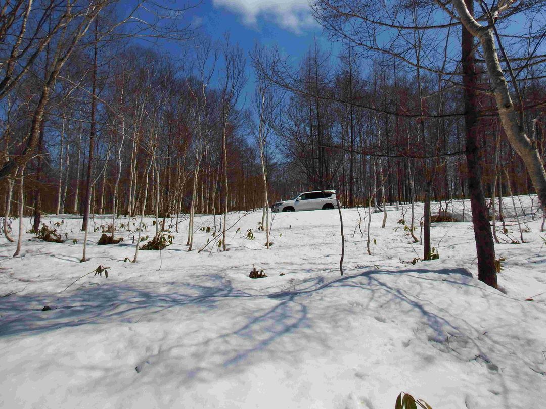
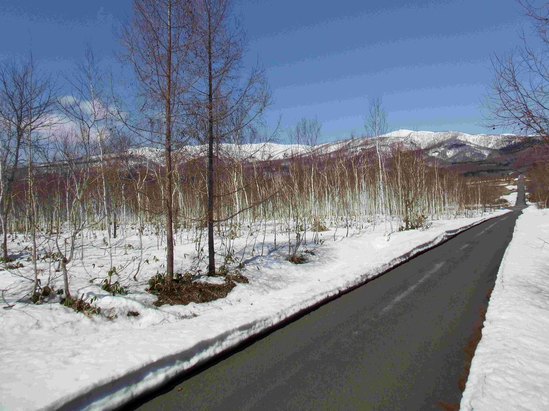
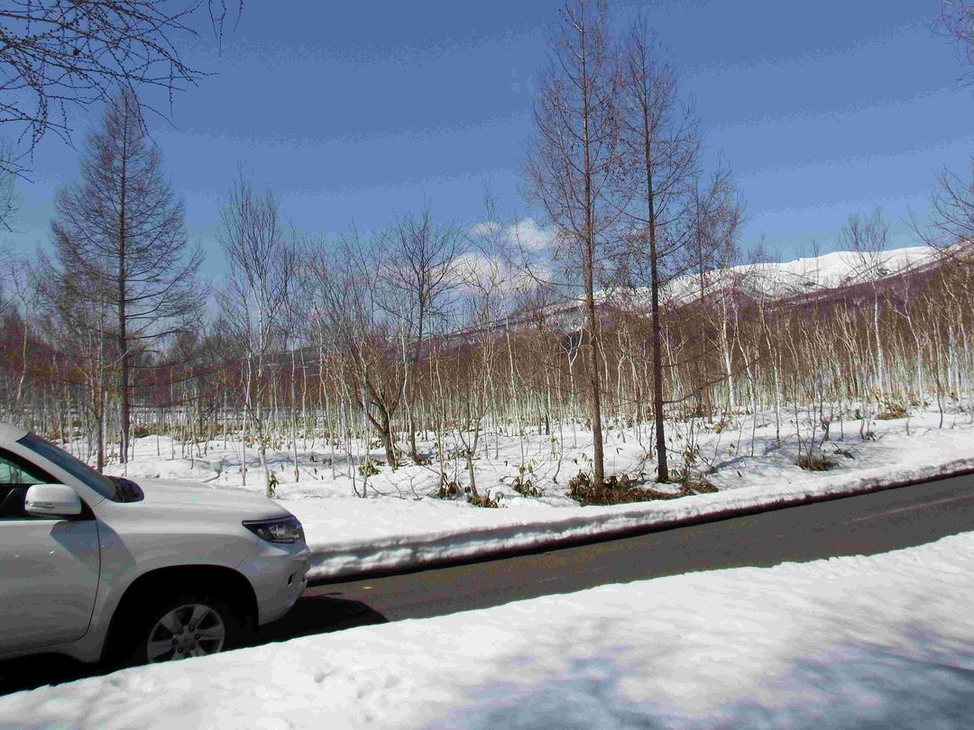
This expansive property presents a rare opportunity to acquire 47,947 square meters (approximately 14,503 tsubo) of forested land in the scenic Rankoshi Town, Hokkaido. The land is classified as 'forest' and features a gentle slope descending from the south to the north. It fronts a 4-meter wide municipal road on its southeastern side, though please note this road is not currently cleared of snow in winter. The town typically performs snow removal in early spring to reopen access.

Essential utilities are available in the area, including Hokkaido Electric Power, LPG, and NTT communications. While the property is within the public water supply zone, the main water pipes are located across Prefectural Road 229 to the north and along the municipal road to the south. Connecting to either would likely incur significant cost, making well drilling a potentially more viable option for water supply.

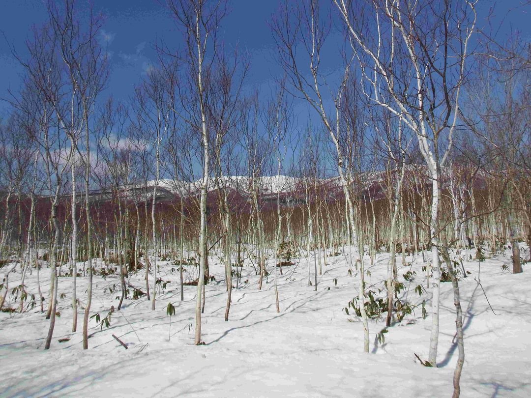
The land is currently a birch-centered forest, offering a serene natural environment. A key feature is the property's stunning view of the Niseko mountain range. The location is within Rankoshi Town, famous for its delicious rice and hot springs. The site is registered under the Land and Forest laws.

Access is convenient, located approximately 4.3 km from JR Hakodate Main Line's 'Rankoshi Station'. Please be aware that a long, narrow section of land at the southwest corner (parcel 237-6) is an irrigation canal owned by the Rankoshi Town Land Improvement District and is not part of this sale. The price for this vast tract is currently under negotiation.

This description was AI-generated from the original Japanese listing and may contain inaccuracies. Please verify details with the source listing.

Summary

Land size: 47,947 / 516,102sqft

Short-Term Rental (Minpaku)

Transport

CTS

New Chitose Airport — 97 km away

Nearby Konbini

Lawson Lawson — 39 min walk

Internet Connectivity

Natural Hazard Assessment

Flood Risk Low Risk
Landslide Risk Moderate
Tsunami Risk Low Risk
Earthquake Hazard Moderate

Unlock hazard data with a free trial

Flood, landslide, tsunami & earthquake risk for this property

3 days free · cancel anytime

Start Free Trial

Purchase Cost & Tax Estimates

Agent fees, acquisition tax, registration costs & annual property tax

Map & Street View

Map loading...

Location Accuracy Notice: Although we try to make the map accurate with coordinates or address details provided, the location data is provided by the agent. This map data should be used as reference for the surrounding area foremost.

Location Type Beds Price Land House View

* Sold properties shown for price comparison only. Prices reflect historical sale data.

Location Type Beds Rent/Month Land House View

* Rental prices shown are monthly rates. Contact property owner for current availability.

Dev Bot
Task #
Draw to highlight areas, then tap Done to attach