Back to results Land for Sale in Niseko with Mount Yotei Views - 538 sqm

Needs Verification

This listing hasn't been verified recently. Tap to request a priority check!

Know someone who would love this? Gift them a subscription

Price on Request

267 Kondo, Niseko Town, Abuta District, Hokkaido

北海道虻田郡ニセコ町字近藤267番

Sign in to save properties

Buy Land Ski Resort Area Corner Lot Panoramic View Rural Near School

Unlock the full description with a free trial

Includes AI translation, hazard data, cost estimates & nearby amenities

3 days free · cancel anytime

Start Free Trial

Schoolside Land Kondo 162: A Bright Plot with Mount Yotei Views

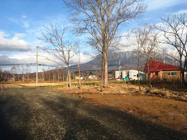
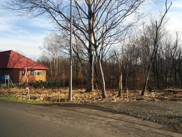
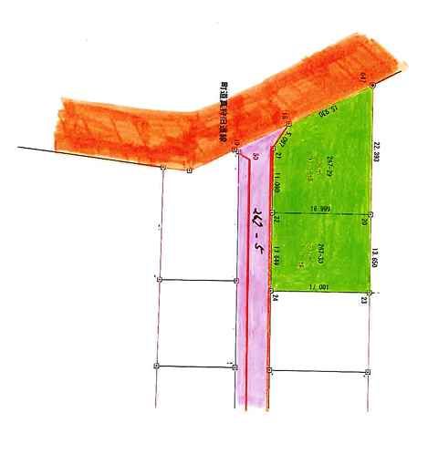
This land parcel, designated as Schoolside Land Kondo 162, offers a prime development opportunity in the sought-after Niseko area. The property is a 538 square meter (approximately 162.75 tsubo) plot of land classified as wilderness. It is situated on a corner lot bordered by a municipal road and a private road, providing excellent access.

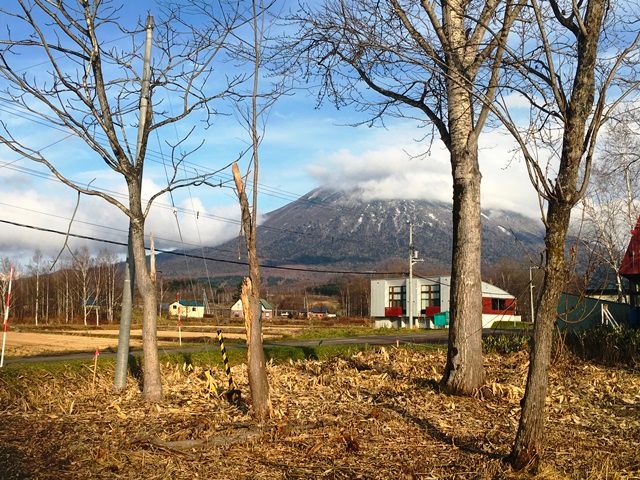
According to the agent's notes, the property is equipped with public water supply. The land is located next to Kondo Elementary School and boasts clear, unobstructed views of Mount Yotei, making it a bright and open site. A specific note mentions that the purchase includes a share (2/46) of the private road portion identified as 267-5. The seller requests that any future building constructed on the lot be limited to one general building. The land falls outside of an urban planning area, has no designated use district, and is subject to Niseko Town's landscape ordinance. The maximum building coverage ratio is 70% and the maximum floor area ratio is 400%.

The area is renowned for its world-class powder snow and outdoor activities, transforming from a winter sports paradise into a lush green destination in the warmer months. An interesting fact is that Niseko's name is derived from the Ainu word "nisei-ko," meaning a cliff by a river. The closest major landmark is the majestic Mount Yotei, often referred to as "Ezo Fuji" due to its striking resemblance to Mount Fuji.

This description was AI-generated from the original Japanese listing and may contain inaccuracies. Please verify details with the source listing.

Summary

Land size: 538 / 5,791sqft

Short-Term Rental (Minpaku)

Transport

CTS

New Chitose Airport — 83 km away

Nearby Konbini

Seven Eleven Seven Eleven — 8 min walk

Internet Connectivity

Natural Hazard Assessment

Flood Risk Low Risk
Landslide Risk Moderate
Tsunami Risk Low Risk
Earthquake Hazard Moderate

Unlock hazard data with a free trial

Flood, landslide, tsunami & earthquake risk for this property

3 days free · cancel anytime

Start Free Trial

Purchase Cost & Tax Estimates

Agent fees, acquisition tax, registration costs & annual property tax

Map & Street View

Map loading...

Location Accuracy Notice: Although we try to make the map accurate with coordinates or address details provided, the location data is provided by the agent. This map data should be used as reference for the surrounding area foremost.

Location Type Beds Price Land House View

* Sold properties shown for price comparison only. Prices reflect historical sale data.

Location Type Beds Rent/Month Land House View

* Rental prices shown are monthly rates. Contact property owner for current availability.

Dev Bot
Task #
Draw to highlight areas, then tap Done to attach