Back to results Large 58,669 sqm Forest Land for Sale in Niseko, Hokkaido

Needs Verification

This listing hasn't been verified recently. Tap to request a priority check!

Know someone who would love this? Gift them a subscription

Price on Request

Niseko Town, Abuta District, Hokkaido

北海道虻田郡ニセコ町字ニセコ315番

Sign in to save properties

Buy Land Ski Resort Area River View Forest Large Garden Well Water Rural

Unlock the full description with a free trial

Includes AI translation, hazard data, cost estimates & nearby amenities

3 days free · cancel anytime

Start Free Trial

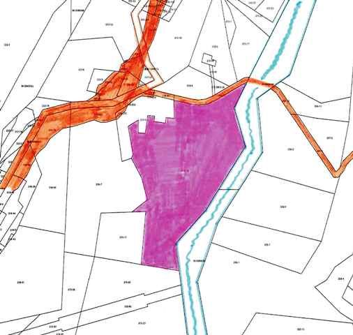
Riverside Land Niseko 17,747: A Vast Natural Property

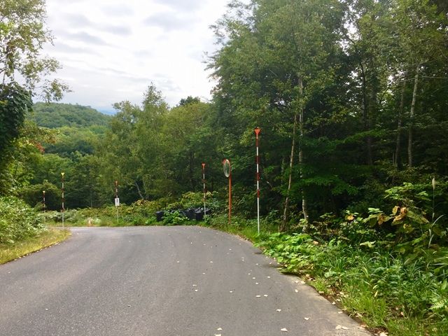
Critical details from the agent's notes must be highlighted. The property's equipment and facilities are listed as: no water supply; well drilling required. This is a crucial consideration for any development plans, as securing a private water source will be necessary. The land is classified as forest land ('sanrin') and is located outside of any urban planning area, with no specific land use zoning applied, offering significant flexibility. However, it is subject to Niseko Town's landscape ordinance. The building-to-land ratio is 70% and the floor area ratio is 400%. The transaction is handled via agency, with the handover date open for consultation.

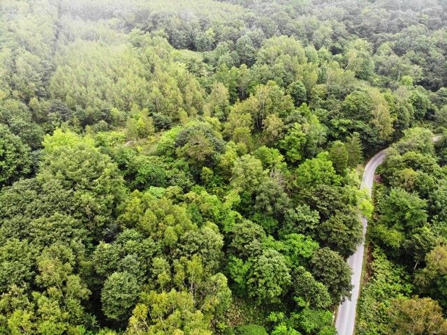
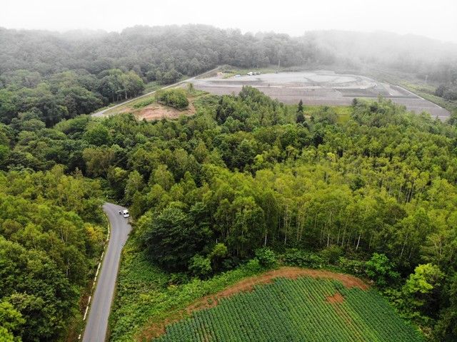
A notable feature of this land is the presence of a small stream flowing through the property, adding natural charm and potential for scenic landscaping. The location offers convenient access, being approximately a 7-minute drive (about 5.07 km) from JR Hakodate Main Line's 'Konbu' Station.

The surrounding Niseko area is world-famous for its exceptional powder snow, attracting skiers and snowboarders from across the globe. Beyond winter, the region transforms into a lush green paradise ideal for hiking, golf, and enjoying the natural hot springs (onsen). An interesting fact is that Niseko's name is derived from the Ainu word 'nisei-ko,' meaning 'a cliff jutting over a riverbank deep in the mountains,' perfectly describing its dramatic landscape. The closest major landmark is the iconic Mount Yotei, often called 'Ezo Fuji' for its striking resemblance to Mount Fuji, which dominates the skyline and provides a breathtaking backdrop to the area.

This description was AI-generated from the original Japanese listing and may contain inaccuracies. Please verify details with the source listing.

Summary

Land size: 58,669 / 631,513sqft

Short-Term Rental (Minpaku)

Transport

CTS

New Chitose Airport — 83 km away

Nearby Konbini

Seven Eleven Seven Eleven — 8 min walk

Internet Connectivity

Natural Hazard Assessment

Flood Risk Low Risk
Landslide Risk Moderate
Tsunami Risk Low Risk
Earthquake Hazard Moderate

Unlock hazard data with a free trial

Flood, landslide, tsunami & earthquake risk for this property

3 days free · cancel anytime

Start Free Trial

Purchase Cost & Tax Estimates

Agent fees, acquisition tax, registration costs & annual property tax

Map & Street View

Map loading...

Location Accuracy Notice: Although we try to make the map accurate with coordinates or address details provided, the location data is provided by the agent. This map data should be used as reference for the surrounding area foremost.

Location Type Beds Price Land House View

* Sold properties shown for price comparison only. Prices reflect historical sale data.

Location Type Beds Rent/Month Land House View

* Rental prices shown are monthly rates. Contact property owner for current availability.

Dev Bot
Task #
Draw to highlight areas, then tap Done to attach